› Forums › Geocaching in Wisconsin › General › Wisconsin Four Corners….
- This topic has 20 replies, 9 voices, and was last updated 16 years ago by
 Trekkin and Birdin.
-
AuthorPosts
-
01/23/2010 at 5:43 pm #1729458
I discovered this new challenge cache in Minnesota. (Cut me some slack, y’all, I grew up there!)
GC21RZH
Anyway, take a look and then think….how could this translate to a state like Wisconsin with two rounded “corners?” We do have an edge, in that there is a cache placed at the exact center of the state.
Would you lay out the map, draw an X intersecting that center cache and then see what’s closest to the border crossings? Ideas please. It could be kind of a fun challenge cache for those of use who’ve done the others and still like to wander the state. Or for those still working on DeLormes to keep in mind as they travel.
01/23/2010 at 9:01 pm #1920854OK, been there, done them ….. where’s the final?
01/23/2010 at 9:19 pm #1920855But Marc, This cache is the exact geographic center, and the one where I’d cross my lines.
GCPNJC
How do you draw maps like that? I was just going to take out an old highway map and a yardstick, but that’s way cooler.
I still need to get Weird Wisconsin placed and posted. We can look at this one next. Where to put it?
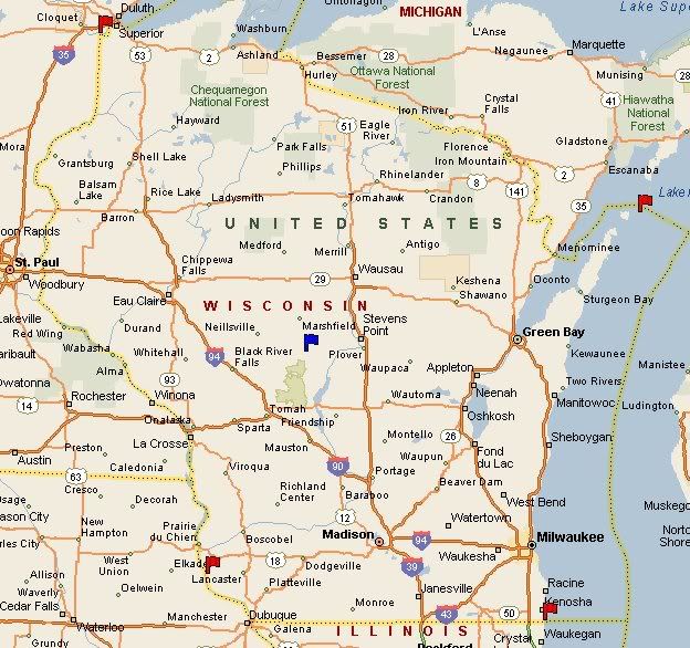
01/23/2010 at 10:10 pm #1920856Interesting idea, I’m ready to run. If you adjust the lines to the actual yellow border corners I think it puts the x right on CodeJunkies house :>
01/23/2010 at 11:17 pm #1920857Microsoft Streets and Trips.
Then cut and paste, and save to Paint. Open photo editor, and crop down the size. Post to WGA photo album, and finally, paste into this forum.
01/23/2010 at 11:52 pm #1920858@Trekkin’ and Birdin’ wrote:
But Marc, This cache is the exact geographic center, and the one where I’d cross my lines.
I’m thinking that maybe the exact geographic center is something like if you put the state on a pin there, the whole thing would be equally balanced. Since Wisconsin is odd-shaped (and full of oddballs), it won’t balance where the straight lines cross.
Michigan has a series of the farthest east, west, north, and south caches in the state, which would be OK here except for the south, which would have to be outlined with a series of micros 0.1 miles apart. 😉
Lots of ways you could go with this idea.
01/23/2010 at 11:58 pm #1920859GSAK tells me that the caches would be:
NW: GCR83Z
NE: GC1G5H9
SW: GCGAX2
SE: GCQMJDGCQMJD is temp disabled, so the next closest would be GCQHB5, and GCT8WC is closer to the corner, but it’s not in Wisconsin.
01/24/2010 at 12:13 am #1920860I should have pointed out that with the irregular geography someone else might come up with a different way of figuring things. The caches I listed are just the most NW, NE, SW and SE in the state. I think only the SW one can be disputed. But…. your challenge, your rules. 😉
 01/24/2010 at 1:00 am #1920861
There isn’t something across the border from Dubuque? There used to be.
The way the MN one works is that they have the extremes listed for the “purists” and lat/long reference points for each corner. Players can find any cache within 20 miles of those reference points within the state. Since the new guidelines for challenge caches require “choice,” this would probably be the way to go.
We were planning to go caching tomorrow, but it’s raining, raining, raining. If that continues, maybe I’ll go put this one out. It’ll be a 5 terrain, but not a “tough” 5.
01/24/2010 at 1:05 am #1920862There are caches closer to the Dubuque corner, but that’s farther South and East, so not really the farthest SW. But, l guess that would be more of a corner…
01/24/2010 at 2:26 am #1920863The cache by Dubuque was a premium member cache and vanished about mid July I believe (have to check to see). Surprised that it hasn’t been replaced as it was in a good location for one.
Be interesting to see this challenge, if the required locations are where the lines end on Marc’s map I may have a few years to try or would the northeastern location be weighted more towards the north?01/24/2010 at 2:36 am #1920864There were two at that welcome center. I managed to whiff on the 1/1. Glad it’s been archived, LOL.
01/24/2010 at 2:37 am #1920865East of Rock would be the purist’s cache. Any Wisconsin cache within 20 miles of it will count.
If that’s where it ends up, which it probably will.
01/24/2010 at 2:45 am #1920866Wow! Now that East of Rock is an interesting location! I was hoping more towards Watersmeet, then I’d have two areas covered and be ready for one of your challenges.
01/24/2010 at 4:41 pm #1920867Woe is me! I am trying to locate Google Earth on my computer, which seems to have literally vanished. I’ve reinstalled four time, and it’s still nowhere to be found. Spooky.
So…..if anyone here can look at the actual geographic corners…..particularly by Dubuque and Kenosha….to share the actual coordinates for those spots, I’d be mighty grateful.
Better yet, come on over and find my *$*()*% google earth!
Hoping maybe to get this in place and submitted today. Sorry Paul. I’m going with the Door County one. Since Wisconsin’s “corners” up north are so wonky, I’m going to stick with the geographic extremes. You can still get mainland stuff in Door County for that one, since I’ll use the 20 mile rule. I highly suggest Europe Bay. We encountered a pair of wolves in a snowstorm coming out of there. One of those magical caching moments for sure.
-
AuthorPosts
- You must be logged in to reply to this topic.