› Forums › Geocaching in Wisconsin › General › Is anyone still around "down there"?
- This topic has 42 replies, 29 voices, and was last updated 17 years, 7 months ago by
 Sloughfoot.
-
AuthorPosts
-
06/10/2008 at 3:29 am #1890140
Lake Delton video:
Holy crap! This is the first I’ve heard of it. I was just finding a cache right next to the Rock River in Jefferson and it is the highest I’ve ever seen it. And in the Fort Atkinson paper this evening, they were talking about how they’ve never seen the river rise this quickly. It’s going to crest higher than it did after the massive snow thaw we had earlier this year. But at least nobody’s house around here has floated away…yet.
All weekend I kept thinking of the line from the old Bill Cosby “Noah and the Ark” routine. Every time Noah would start kvetching, God would interject, “Noah, how long can you tread water?”
“What’s a cubit?”
Apparently there was a tornado in Fort Atkinson. So me and the pets went to the basement. That’s not a transportation issue for three cats and a small terrier. Carrying a 60 pound greyhound down (and later up) stairs is not fun. But I did some laundry and made sure my sump pump was working.
According to the paper, there were funnel clouds over Fort, but thankfully no confirmed touch down. My daughter and I were stuck in the Ace Hardware when the sirens went off. We hung out there for a while and watched the hail until it let up enough for us to leave. Some of those clouds were pretty eerie.
06/10/2008 at 3:34 am #1890141@AuntieNae wrote:
If you ever found The Nature Study cache, read his log on the rescue of the cache .. GCVQV6.
Hey, I remember that one! I commend Brian for his cache rescue efforts.
06/10/2008 at 3:34 am #1890142Those micros way up in the branches of pine trees should become a hot item again–you can find ’em in the winter, you can find ’em in a flood…
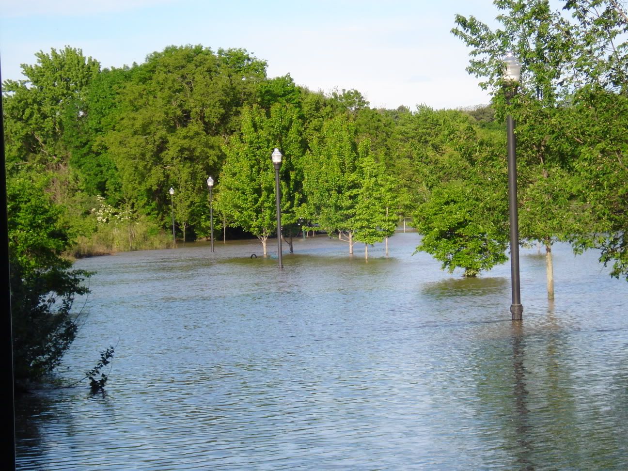
06/10/2008 at 4:23 am #189014306/10/2008 at 11:29 am #1890144Racine didn’t get the big big stroms, but starting Sunday the root river kept rising. Many of our caches are under up to 4 ft of water. weeeee boat caches. I have never seen the river this high. we have one high school submerged. Island park is now atlantis. the entire park is 4 ft under and the rivers that surrond the park have merged into one lake.
the new bike trail along the river is gone. it is really weird to see the lamp post popping up from the water. I live on a hill so all is well for me, but there are a few sections of the city that are shut down.
StarWarsGuy
here is a good photo of a bike trail gone bad. See if you can find the park bench
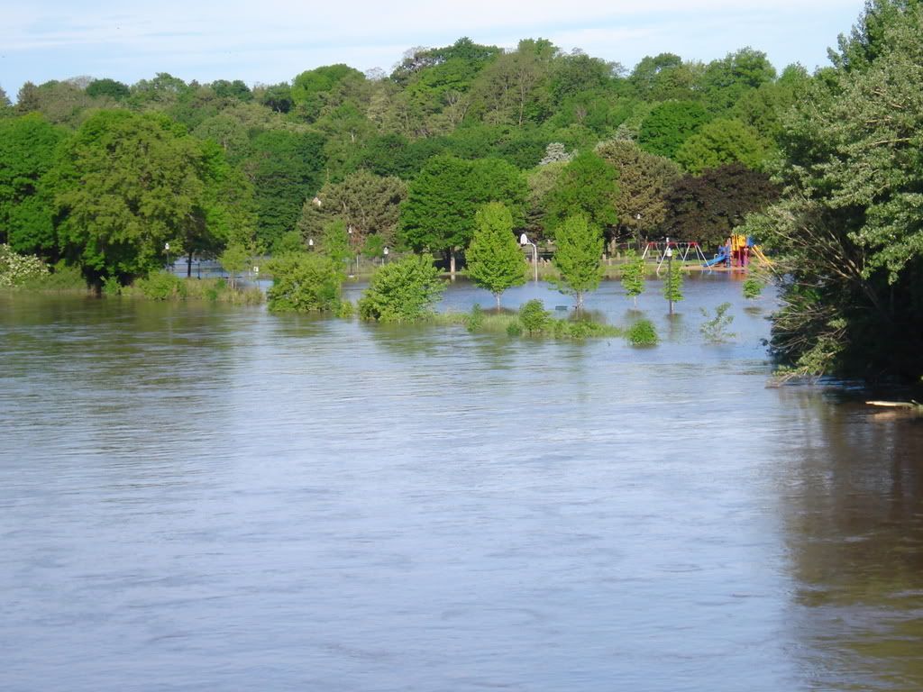
follow the lamp posts to stage 2 of a multicache
 06/10/2008 at 11:59 am #1890145
The areas along the Kickapoo River were hit again in this mess, and the emergency officials are saying that it is actually worse than last August’s “100 Year Flood.” News photos last night showed Gays Mills downtown under water.
When we were coming home the other night, we drove through Elroy, and as we were driving west along 71, I said “Am I nuts? I don’t recall wetlands on this stretch of highway.” It was the Baraboo rising, and shortly after we’d passed through, parts of Elroy were evacuated.
For anyone affected by this latest round of storms and floods, our thoughts are with you.
06/10/2008 at 1:54 pm #1890146I obliviously cached through Madison on Sunday catching the morning and evening downpours. Besides seeing quite a few creeks really moving I was unaffected and Mad-town had only minor noticeable flooding. I really feel for you guys though, and hope everyone stays safe.
We have a chance of storms every day this week up here, are the forecasts worse down there?
06/14/2008 at 12:41 am #1890147Well the rain stopped shortly before 5:00 a.m. by us. No rain for the rest of the day too. I hate to say it, but the sun has even been out for the last couple of hours. I hope everyone is doing ok after this latest round of storms. Once again, we got about an inch of water in the basement. We can’t complain about it though, there are many others a lot worse. I hope we can all start drying out now and get some of our sanity back.
06/14/2008 at 1:03 am #1890148I was just reading online about the DNR closing a few parks and trails, thought I would share the article for anyone planning on going out this weekend.
http://www.madison.com/tct/news/291383
Also the WI DOT has made a google map of road closures that can be found here:
06/14/2008 at 2:59 am #1890149Thanks for the links I had to be sure that Beaver Dam was not Beaver River again. Also the Dam in Beaver Dam is just about maxed out. There is also a building downtown in Jeopardy of collapsing which would then block the river and flood the entire downtown.
I was also worried that the Rock river spilled into 151 again in Waupun.
06/14/2008 at 10:48 pm #1890150Almost made it today without rain. At least this one moved through quickly. Looks like we might get some though.
06/23/2008 at 5:53 pm #1890151Team Sloughfoot would be disabling caches if we had any way to check on them. Our caches in the Portage area are for the most part underwater or unapproachable due to road closures. Our cottage between Portage and the Dells is flooded, again. 2nd time in 4 years. The floor is ripped up in the lower level and all the furniture is in the garage. Sorry to anyone who makes a wasted trip to one of our caches but we are too busy with water issues and elderly mother rescues to do the computer work . Pray for a drought. 😥
06/23/2008 at 5:54 pm #1890152Team Sloughfoot would be disabling caches if we had any way to check on them. Our caches in the Portage area are for the most part underwater or unapproachable due to road closures. Our cottage between Portage and the Dells is flooded, again. 2nd time in 4 years. The floor is ripped up in the lower level and all the furniture is in the garage. Sorry to anyone who makes a wasted trip to one of our caches but we are too busy with water issues and elderly mother rescues to do the computer work . Pray for a drought. 😥
-
AuthorPosts
- You must be logged in to reply to this topic.